Duration: 3.5 hours at a very leisurely pace

Board bus #94 in Sai Kung town or #96R on public holidays and Sunday from Diamond Hill MTR. Get off at the stop called Tai Tan 大灘, which from Sai Kung is just over 20 minutes away. Don't confuse with an earlier stop called Tai Wan 大環. The display screen on the bus shows what the next stop is.
To the left of the bus stop is a sign for Tai Tan.

Follow the concrete path into Tai Tan Village. It is a charming hamlet with an unimposing entrance (ie building works and a small carpark). Shame about the plot of land in front of the village that has clearly been illegally destroyed by diggers. Typically, the government has put signs up declaring its ownership of the land but has done nothing to remedy the ugly scar on the landscape. At least the cows don't seem bothered by it.

Once you've crossed a little bridge into the village, you'd probably feel inclined to head for the sea, visible through a little gateway to the right of a row of houses. But that just takes you to a small pier from where the residents must launch their rowboats.

Instead, you should veer left after the bridge and follow the path up a flight of steps that takes you away from the sea. Don't worry. You'll see plenty of the coast later!

There is a well-preserved row of old village houses up on a small hill, a rarity in the New Territories where so many have sadly fallen derelict. The one at the end looks particularly smart.


Soon you'll reach the end of the village path which takes you to the coast, and here's the start of the Tai Tan Coastal Walk. There is a row of houses there which share their front gardens with a herd of Sai Kung's resident feral cattle. Note the yellow, temporary looking sign pointing towards Hoi Ha Wan. It says it'll take three hours to cover 7km, which may strike hardier walkers as too unambitious, but not at my pace!


The path is a work of amazing craftsmanship. Hats off to the people who carefully laid down thousands of pieces of leveled stones for the sake of hikers.

It's a nice, flat walk (roughly an hour) that takes in views of the aptly named Sharp Peak and the lovely mangroves. It feels a bit frustrating at times when you can see the coast and hear the lapping of the waves but just can't get down to it. Be patient!

 |
| Looking back at Tai Tan Village |
 |
| Wong Shek Pier, visible across the water |
Finally! Tai Tan, the big beach itself. But it 's not very big at all. Shame about the rubbish and dead fish strewn all over the place. Otherwise, it really is quite stunning. (N.B. pictures taken on an overcast day)

Walk to the other side of the beach and carry on along the unmarked trail that takes you to the rocks. The rocks are flat and easy to get over. You'll soon join up with the main trail taking you uphill.


The upward trek comes as a bit of a shock to the old thigh muscles after an hour of complete flatness. But the view is going to be worth it.

 |
| Sharp Peak on the left |

 |
| Don't go straight on. Follow the steps on the right |
From here, it's a narrow dirt path all the way to Hoi Ha. You'll inevitably stop dozens of times to gaze at the sea, Sharp Peak and Tap Mun Island. I think that's the main reason why the 7km takes all of three hours.


 |
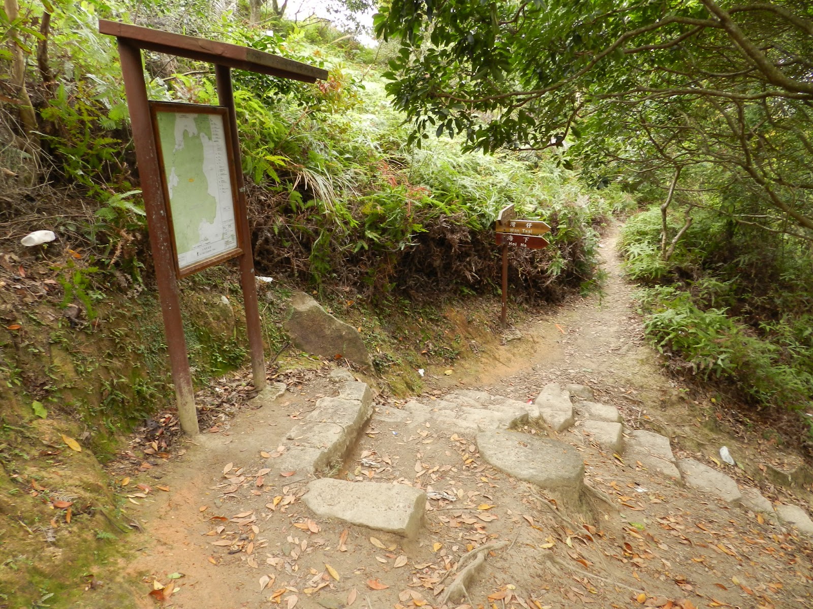
With about half an hour left of the walk, you come to the junction with "Wan Tzai" 灣仔. The place name in Chinese is the same as Wanchai, but they couldn't be more different. I didn't go round Wan Tzai this time (it's a beautiful walk around the peninsular to the right of Hoi Ha). Instead, I walked past the entrance to the Wan Tzai camp site and turned left up the hill for Hoi Ha.


 |
| A view of Hoi Ha Wan, famous for its coral reefs |

 |
| Hoi Ha's old lime kilns |
 |
| Hoi Ha Village |
 |
| Sampan at Sai Kung pier selling fresh seafood of all kinds |
 |
| Chuen Kei Seafood is one of the largest and most well established |
 |
| Steamed scallops with garlic and vermicelli. |
Enjoy!
No comments:
Post a Comment